
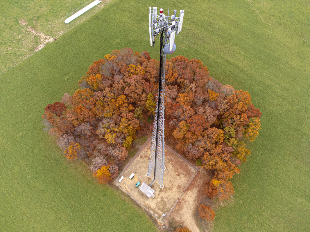
Most counter-drone proposals start by adding hardware: another radar mast, another RF detector, another camera turret. Ericsson is pitching the opposite. Its newly announced Integrated Sensing and Communication (ISAC) System is built to turn mobile network infrastructure that already exists into a wide-area drone detection layer, using sensing-capable 5G radios spread across several cell sites to find and follow small aircraft, including ones that never connect to the network.
The idea is appealing because cell sites are already everywhere that low-altitude airspace security is a problem: cities, ports, stadiums, transport hubs. The caveats are real, though. Ericsson's own schedule puts small, sensing-only commercial pilots in 2027 and broader deployments in 2028. The company describes the system as a complement to radar and dedicated counter-drone systems, not a replacement. And the most detailed public analysis of how drone sensing competes with ordinary network traffic is, for now, a simulation study.
Below is what Ericsson is claiming, what has actually been demonstrated, and what remains open.
What is Ericsson actually proposing?
According to DroneDJ's Nov. 2 report, the ISAC System uses multi-static sensing across geographically separated network sites. Rather than one radio transmitting and listening for its own echo, as a conventional monostatic radar does, several sites contribute to detection, so a target can be seen from different angles at the same time.
The important operational detail is that the target drone does not need to be connected to the network. A cellular network can already locate devices that register with it; a drone that is flying dark, with no SIM and no cooperative transmitter, is a different problem. Ericsson's pitch is that its radios can sense those non-cooperative aircraft too.
Ericsson says validated tests reliably detected and tracked micro drones at kilometer-scale with precise 3D positioning. The company also notes that performance depends on the drone, the terrain, the geometry of the sites and the configuration, which is an important qualifier for anyone treating "kilometer-scale" as a spec-sheet number. Detection data is shared through standardized interfaces with security platforms, which means the network acts as a sensor feeding someone else's command-and-control picture, not as a standalone counter-drone system.
Where has it been tested?
DroneDJ describes three trials, each with a different partner and emphasis.
Arlington, Texas, with AT&T. ISE Magazine reported in July that the two companies demonstrated ISAC using Ericsson Massive MIMO radios, synchronized cellular sites and AI-enabled sensing and signal processing, in authorized airspace outside AT&T Stadium. Multiple drones flying between 300 and 400 feet were detected and tracked continuously, with location, velocity and elevation data, and without standalone radar.
Helsinki, with Erillisverkot. Finland's critical-communications operator ran a demonstration with Ericsson on Sept. 16-18, including a live trial at Vuosaari Harbor, according to Telco Magazine. Several network points collected sensing data simultaneously, which is the multistatic arrangement in practice. Ismo Parviainen, of Finland's Ministry of the Interior and a member of Erillisverkot's board, said ISAC can complement existing sensing and build on existing mobile infrastructure. The framing from a government official is notable: complement, not replace.
Poland, with Play and Asseco. The Polish trial pairs Ericsson's network sensing with Asseco's PUSZCZYK acoustic system, per DroneDJ, which says the combination showed how radio-based and acoustic detection could work together to improve the positioning of low-flying drones. Fusing different sensor types is a recognizable counter-UAS pattern: different sensors fail in different conditions, so combining them can give operators more confidence than any single feed.
Why not just use radar?
Ericsson is careful not to argue that it should replace radar, and that restraint is telling. Dedicated counter-drone radars are designed, sited and tuned for one job. A cell network is designed to carry phone calls and data, and every bit of radio time spent sensing is radio time not spent serving subscribers.
The argument for ISAC is coverage and cost of presence. A dedicated sensor network has to be bought, installed, powered and maintained site by site. A mobile network already has sites, power, backhaul and spectrum across large areas. If sensing can be layered on top, an operator could offer persistent low-altitude awareness over an area no counter-drone program would realistically cover with purpose-built sensors. In that model, ISAC is the wide, coarse net, and radar, electro-optical and acoustic systems are the specialized tools brought in where the threat warrants them.
What does the research say about the trade-offs?
The central engineering tension, sensing versus communications capacity, is the subject of a June arXiv paper by Dickerson, Khawaja and Guvenc, "Adaptive 5G Resource Allocation for Multistatic ISAC-Based UAV Detection and Tracking." It is not an Ericsson paper and does not evaluate Ericsson's product, but it addresses the same architecture.
The authors build a shared-resource framework to quantify how sensing waveform length, sensing rate and beam allocation affect communication throughput in 5G New Radio. They use Zadoff-Chu sensing waveforms and an M-of-N detection model, in which a track is maintained if a target is detected in enough of a series of looks, to measure tracking continuity. They also add software-defined sensor nodes that use external signals of opportunity, listening passively to existing transmissions, so sensing can continue when network resources become limited.
Their results point in a sensible direction, and the tracking-outage result is explicitly from simulated scenarios:
- Adaptive policies that adjust sensing resources to network load beat fixed sensing reservations on preserving throughput.
- Assistance from the passive software-defined sensor nodes substantially reduces tracking outage under heavy congestion in the simulated scenarios.
- Cramer-Rao lower bound analysis shows multistatic geometries improve localization accuracy and provide more uniform spatial coverage than monostatic sensing alone.
The last point supports the multi-site design Ericsson is using. The first two highlight the operational risk: under heavy load, a network that holds a fixed slice of capacity for sensing either hurts subscribers or loses tracks. The study's proposed fixes are promising, but the abstract describes simulated scenarios, not field measurements on a busy commercial network.
What is still unproven?
Several questions are not answered by the material made public so far.
Performance at scale. The trials are demonstrations at specific sites with chosen geometry. Ericsson's own qualifier, that results depend on drone, terrain, geometry and configuration, suggests coverage across an entire metro network would be uneven.
Behavior under real traffic. The arXiv work shows why load matters but tests it in simulation. How a production network divides capacity between sensing and paying customers during peak demand is the kind of thing the 2027 pilots will need to show.
Integration and response. The system hands data to security platforms through standardized interfaces. Detection is only the first link in a counter-UAS chain; classification, decision-making and any response stay with other systems and other authorities.
Timeline. The 2027 pilots are described as selected, small-scale and sensing-only, with broader deployments in 2028. The integrated communications component is to be added as the technology evolves toward 6G. For now, this is a sensing add-on to 5G, not a finished converged network.
Why It Matters
Low-altitude airspace awareness is one of the hardest gaps in drone security. Small drones fly low, are hard to detect with conventional security infrastructure, and often do not broadcast anything a cooperative system can pick up. Purpose-built sensors work, but nobody can afford to blanket a country with them.
Mobile networks already blanket the places where drone incidents tend to matter. If Ericsson's approach holds up in commercial pilots, carriers and critical-communications operators like Erillisverkot could become suppliers of a baseline airspace picture, feeding detections to security platforms and command-and-control systems, where specialized sensors and response tools can be brought to bear. The participation of AT&T, Finland's critical-communications operator and a Polish carrier paired with a domestic technology company shows Ericsson is testing the approach with partners in more than one country.
The honest read is that this is a credible direction, not a deployed capability. The demonstrations are real, the case for multistatic sensing is supported by the research, and the vendor itself is positioning the system as one layer among several. The things that will decide whether it matters, consistent performance across varied terrain and sensing that does not degrade service on busy networks, will be tested in 2027, not in press releases.
Sources
- Forget new sensors. Ericsson wants 5G towers tracking drones (DroneDJ, Nov. 2, 2026)
- Adaptive 5G Resource Allocation for Multistatic ISAC-Based UAV Detection and Tracking (arXiv:2606.21677, Dickerson, Khawaja, Guvenc, June 19, 2026)
- Ericsson: How 5G Networks Could Track Drones in Real Time (Telco Magazine, Sept. 21, 2026)
- AT&T and Ericsson Demonstrate 5G Integrated Sensing for Drone Detection (ISE Magazine, July 14, 2026)