A ground control station is the nervous system of any unmanned aircraft operation — the interface through which an operator commands the vehicle, monitors its telemetry, loads mission parameters, and manages the communications links that make flight possible. The form factor varies wildly: a hobbyist quadcopter's radio barely qualifies, while a U.S. Air Force MQ-9 Reaper squadron operates from hardened shelter systems staffed by a pilot and sensor operator, with satellite uplinks capable of handing off aircraft between ground stations on opposite sides of the globe. What ties these extremes together is a common set of software abstractions, communications protocols, and interface paradigms that have coalesced over the last fifteen years.
The Language Drones Speak: MAVLink and the Open-Source Stack
The protocol underpinning nearly every civilian and defense-research UAS communications stack is MAVLink — Micro Air Vehicle Link — released in 2009 by Lorenz Meier; the C library and message definitions ship under the MIT License, with the generator toolchain under LGPLv3. What looks deceptively simple is a lightweight binary serialization format for telemetry and command messages that has become the de facto lingua franca of open-platform UAS. It powers the two dominant open-source autopilot systems — ArduPilot and PX4 — and as Anis Koubaa et al. documented in a technical survey of the protocol, published in IEEE Access in June 2019, MAVLink had already become foundational infrastructure for the field.
Messages are defined in XML dialect files, with the foundational common.xml extended by platform-specific implementations. The protocol targets virtually every hardware and software tier: STM32 and ATMega microcontrollers, Linux and macOS machines, and language bindings for C, C++, Python, Rust, Java, Lua, Swift, and others. It supports up to 255 concurrent systems — vehicles, companion computers, and ground stations — on a single network. The architecture is deliberately hybrid:
"Data streams are sent / published as topics while configuration sub-protocols such as the mission protocol or parameter protocol are point-to-point with retransmission." — MAVLink Developer Guide
MAVLink 1 adds 8 bytes of overhead per packet; MAVLink 2 raises that to 14 bytes in exchange for extended message IDs and per-message signing — a security feature critical when the GCS is communicating over an untrusted RF link.
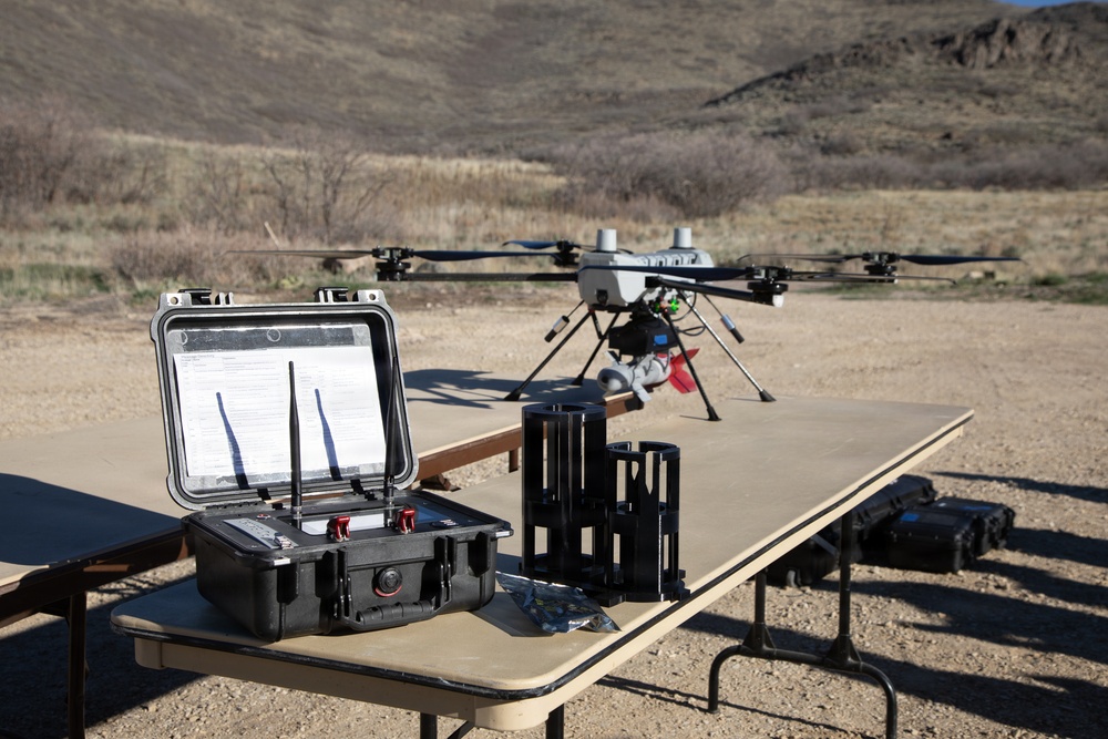
The most widely used civilian GCS in the ArduPilot ecosystem is Mission Planner, developed by Michael Oborne and distributed under GPLv3. It runs on Windows (macOS via Mono) and integrates SITL simulation for pre-flight mission rehearsal, dataflash log analysis, and real-time telemetry graphing. For cross-platform work, QGroundControl — maintained by the Dronecode Project, a Linux Foundation initiative, under Apache 2.0/GPLv3 dual license — runs on Windows, macOS, Linux, iOS, and Android, supporting both PX4 and ArduPilot. Its Stable V5.0 is the current release. Developer workflows often lean on MAVProxy, a Python-based command-line GCS installable via pip — Linux-only, suited to scripting rather than live flight operations. Mobile options extend the stack further: Tower (Android, GPLv3), MAV Pilot, and SidePilot (iOS) cover field tablet use cases. All connect via SiK telemetry radios in the 433 or 915 MHz bands, Wi-Fi, Bluetooth, or USB OTG cable.
Mission Planning and the Datalink
Mission planning in a GCS is built around waypoint definition, geofence configuration, and uploading the mission to the autopilot's on-board storage. Once uploaded, the aircraft can execute autonomously without a continuous command link — architecturally important for operations where datalink continuity can't be guaranteed. SITL simulation lets operators rehearse missions before flight, catching parameter errors without burning airframe time.
The datalink is where BVLOS operations become genuinely complex. Line-of-sight operations use terrestrial RF; beyond visual range, the stack shifts to SATCOM across GEO, LEO, MEO, and HEO constellations. GEO satellites — sitting at roughly 35,000 km altitude — introduce latency that makes real-time manual piloting impractical, confining GEO links largely to telemetry monitoring and payload command rather than precise flight control.
Regulatory architecture shapes the datalink stack as well. The FAA has allocated dedicated aviation C-band spectrum specifically for UAS Control and Non-Payload Communications (CNPC) links. Under FAA rules, loss of the control link must be reported to ATC as soon as practical and may be treated as an emergency — a requirement that forces GCS designers to treat link integrity as a first-order design constraint, not an edge case.
ATAK, the MQ-9, and the Military Tier
ATAK — the Android Tactical Assault Kit — occupies a distinct tier above the GCS in military operations. Originally developed for the U.S. military and now managed by the U.S. Federal Government through the TAK Product Center, ATAK is not a flight control system. It is a geospatial situational awareness engine built on the Cursor on Target (CoT) data format: "a geospatial mapping engine that allows users at the lowest tactical echelon to quickly observe, orient, decide, and act." The ATAK UAS Tool plugin, available to registered TAK.Gov users, receives drone location, Sensor Point of Interest (SPoI) data, telemetry, and Full Motion Video, integrating them into a common operational picture rather than replacing the autopilot link beneath. TAK-MIL adds precision targeting capabilities absent from TAK-CIV, the civilian and first-responder variant.
The contrast with a purpose-built military GCS is instructive. An MQ-9 Reaper system comprises several aircraft, a ground control station, and both LOS and BLOS satellite and terrestrial data links. A crew of two — pilot and sensor operator — may conduct launch and recovery via a forward-deployed mobile Launch and Recovery GCS (LRGCS) while a fixed GCS handles mission execution via Remote Split Operations, handing off aircraft across time zones without interrupting the flight. General Atomics' Block 50 GCS moves toward single-seat operations; GA-ASI says the Block 50 HMI enhances situational awareness and enables single-seat operations, while adding multi-level security feeds and a Multi-Level Secure Integrated Communication System for globally networked GCS and SOC operations. The certifiable CGCS variant targets the MQ-9B SkyGuardian's eventual non-segregated civil airspace operations. GA-ASI's systems are built to deploy, in the company's words, "on any land base, in any aircraft, or on any ship around the world."
Why It Matters
The GCS is where policy meets physics. Every regulatory boundary — BVLOS authorization, spectrum allocation, link-loss procedure — is implemented not in the airframe but in the software and RF stack the ground station manages. MAVLink's emergence as the open binding protocol democratized capable UAS platforms, compressing the gap between a $50 SiK radio and a research-grade autopilot stack. Military programs built vertically integrated equivalents, but even those rest on shared protocol foundations. As UTM frameworks mature and airspace integration advances from segregated test corridors toward routine mixed-traffic operations, the sophistication of the GCS — its ability to maintain reliable links, enforce geofences, adapt to lost-link scenarios, and fold into shared awareness layers like ATAK — will define the operational ceiling of the UAS industry as much as any advance in airframe or propulsion.
Sources
- IEEE Access / arXiv — Koubaa et al., "A Comprehensive Survey on the MAVLink Protocol" (June 2019)
- MAVLink Developer Guide (official documentation)
- QGroundControl — Dronecode Project official site
- ArduPilot — Choosing a Ground Station
- General Atomics Aeronautical Systems — Ground Control Stations
- General Atomics — Block 50 Ground Control Station
- GlobalSecurity.org — MQ-9 Reaper
- SkyFi — ATAK System and Satellite Imaging
- Elsight — How SATCOM Is Used for BVLOS Drone Flights