Between commercial airspace and the lowest orbital shells sits a largely unclaimed atmospheric layer: the stratosphere, at roughly 20 kilometers altitude. Weather stops there. Jet routes don’t reach it. Satellites pass through it only during launch and reentry. For tasks demanding persistent wide-area coverage — surveillance, connectivity, atmospheric sensing — that 20-km band represents a physics-enabled sweet spot that engineers have been trying to exploit for decades. High-Altitude Platform Stations, or HAPS, are the latest and most credible attempt to own it. Neither drone nor satellite, they occupy a niche now attracting serious capital: HAPS publications have roughly tripled since 2014, and the sector has drawn at least nine figures in documented telecom investment — including a $100 million commitment to AALTO from NTT Docomo and Space Compass in 2024.
Why the Stratosphere Rewards the Effort
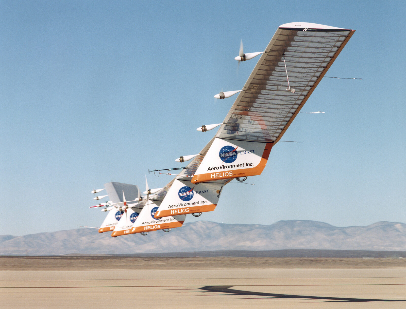
At 20 km (65,000–70,000 feet), air density is approximately 3% of sea-level density. That single number governs everything about what a viable HAPS aircraft has to be. Generating lift in an atmosphere that thin requires enormous wingspans with extreme aspect ratios, and propellers engineered more like the blades NASA’s Ingenuity helicopter used on Mars than anything flying conventional airspace. The Airbus Zephyr Z8 — tracing its lineage to a QinetiQ program begun in 2001, with its first flight in 2004 lasting 27 minutes — spans 25 meters, driven by twin 1.2-meter-diameter high-pitch propellers. BAE Systems Prismatic’s PHASA-35 reaches 35 meters and 150 kg. SoftBank’s Sunglider spans 78 meters. These are not aircraft in any conventional sense.
The stratosphere rewards that structural extremism with stability. Above the convective, turbulent troposphere, airflow is comparatively laminar, enabling months-long loiter that no lower-altitude aircraft can sustain. A HAPS station at 20 km sits roughly 20 times closer to Earth than the International Space Station — close enough to relay signals directly to standard mobile handsets, close enough for optical sensors to achieve 18-centimeter resolution, far enough up to cover thousands of square kilometers from a single vantage point. The zone is also aeronautically empty: above the highest-flying airliners, below any orbital object of consequence.
Temperature is a nonnegotiable engineering constraint. Stratospheric HAPS operate in a −60°C to −80°C environment, with almost no air molecules available to carry heat away passively. Battery thermal management, trivial at lower altitudes, becomes a significant design challenge when the cooling medium essentially disappears.
The Energy Equation
Every solar HAPS runs an identical balance sheet. Solar cells on the wing upper surfaces harvest energy during daylight; that energy simultaneously drives propulsion and charges onboard batteries. At night, stored charge sustains the aircraft until dawn. The fundamental design question is binary: does the battery pack still hold charge when the sun rises, or does the aircraft come down?
The enabling breakthroughs are twin. On the solar side, MicroLink Devices produces space-qualified three-junction cells achieving 30% conversion efficiency, etched to just 50 micrometers thick via epitaxial liftoff — thin enough to sit on wing surfaces without adding meaningful drag or mass. On the storage side, Amprius Technologies’ silicon nanowire anode platform reaches 450 Wh/kg and 1,150 Wh/L, the kind of energy density that makes overnight stratospheric survival arithmetically achievable.
Geography remains a hard constraint no software can fix. The viable operating band for solar HAPS sits within roughly ±25 degrees of latitude. At higher latitudes, winter solstice solar angles reduce energy harvest below the threshold needed to recharge batteries overnight — a physics wall that won’t move until cell efficiency and battery density improve further. AALTO HAPS, the Airbus spin-off now owning Zephyr, is explicitly building its deployment geography around this constraint.
Programs: Records, Failures, and the Road to Revenue
Zephyr Z8 flew 64 continuous days in 2022 before a stratospheric turbulence event ended the flight — the current fixed-wing endurance record. AALTO is targeting 200-day persistence, backed by a $100 million investment from NTT Docomo and Space Compass in June 2024 for Asia-Pacific connectivity deployment. AALTO is also constructing AALTOport, a dedicated launch-and-recovery facility in Laikipia County, Kenya, selected for approximately 10 months per year of favorable atmospheric windows, with a long-term plan for three to four globally distributed launch sites. AALTO specifications put one Zephyr aircraft's connectivity footprint at the equivalent of 250 cell towers, serving roughly 7,500 square kilometers with low-latency direct-to-handset connectivity — plus an Earth observation payload delivering 18-centimeter-resolution imagery at approximately 2,500 km² per day.
PHASA-35 completed a 24-hour stratospheric test flight at White Sands Missile Range on June 24, 2023, reaching 66,000 feet. The program used UK Met Office weather modeling and Honeywell LIDAR atmospheric sensing to navigate the tropospheric ascent, generating what BAE Systems Prismatic metrologist Rory Bell described as “a data point every 150m up to an altitude of 23km.” CEO Dave Corfield declared “every single test point was achieved” and set a 2027 market-entry target, with a Block 20 variant doubling power and energy storage already in development.
The field has collected high-profile failures alongside its records. Google’s Project Loon — a balloon-based HAPS connectivity network — shut down in 2021. Meta’s Project Aquila, a fixed-wing solar HAPS program, was discontinued before reaching commercial deployment. Aurora Flight Sciences CTO Tom Clancy offered a candid sector-wide summary: “Basic fact is, there’s never been an operational solar airplane that has served a customer.” Aurora’s own Odysseus program — a Boeing subsidiary vehicle with a 243-foot wingspan descended from DARPA’s Vulture long-endurance initiative — remains in development, as does SoftBank’s 78-meter Sunglider, which logged five hours in the stratosphere in September 2020 while supporting a 15-hour LTE connection alongside Project Loon.
ESA’s perspective on HAPS architecture is instructive for scale. Its HAPPIEST study modeled an aerostatic (airship) HAPS concept at 181 meters length and 16-tonne takeoff mass, carrying 250 kg of operational payload — illustrating that the fundamental HAPS design space is not limited to fragile ultra-light aircraft. ESA identifies two primary architectures: aerodynamic (fixed-wing, lower payload, faster deployment) and aerostatic (airship or balloon, higher payload and power generation potential). The engineering constraints that produce a 75-kg glider-scale aircraft with a 25-meter wingspan don’t bind a 16-tonne airship the same way.
Why It Matters
The applications pulling investment into HAPS span three distinct sectors simultaneously, which helps explain why the field keeps attracting capital despite repeated program failures. Telecommunications is the most legible case. A 2024 arXiv survey of HAPS communication networks identifies these platforms as core infrastructure candidates for 6G non-terrestrial network (NTN) deployment, capable of carrying gigabit-class free-space optical (FSO) backhaul links with multi-Gbps downlinks. Wahid Nawabi, CEO of AeroVironment, framed the disruption case bluntly: “We believe HAPS will disrupt the multi-billion global telecom cell tower infrastructure business.”
Disaster response carries NASA-backed analysis. For significant wildfires exceeding 40,000 acres, approximately 8 balloon-type HAPS or 23 fixed-wing HAPS could provide LTE coverage for firefighters operating beyond terrestrial wireless range — a coverage gap that currently has no scalable solution. Environmental monitoring adds a third lane: HAPS can host Differential Absorption Lidar (DIAL) instruments simultaneously tracking CO₂, CH₄, N₂O, H₂S, and O₃ at spatial resolutions and dwell times orbital platforms cannot match.
The orbital congestion argument is becoming structural. The ITU has registered approximately 1.7 million potential LEO satellites for launch by 2030 — a figure that raises legitimate Kessler Syndrome concerns. HAPS proponents argue their platforms sidestep the debris problem entirely: a stratospheric vehicle can be recovered, refueled, and re-tasked without generating orbital debris and without competing for spectrum slots. As low Earth orbit becomes genuinely contested, the attractiveness of a non-orbital persistent platform is not merely rhetorical. The 20-km layer has no resident junk problem, no jurisdictional ambiguity, and — once the tropospheric transit challenge is solved — no fundamental reason a well-designed solar aircraft cannot remain there indefinitely.
Sources
- Aerospace America (AIAA) — Meet the Next Pseudo-Satellites
- Airbus — Zephyr High-Altitude Platform
- Royal Aeronautical Society — BAE Systems PHASA-35 Makes Breakthrough Stratospheric Flight
- Inside Unmanned Systems — HAPS/HALE: Seeking Solar’s Sweet Spot
- NASA Technical Reports Server — HAPS Communications Analysis for Wildland Fire Response (2023)
- ESA — Could High-Altitude Pseudo-Satellites Transform the Space Industry?
- arXiv — HAPS Communication Networks: A Survey (2024)
- Amprius Technologies — HAPS Vehicles