
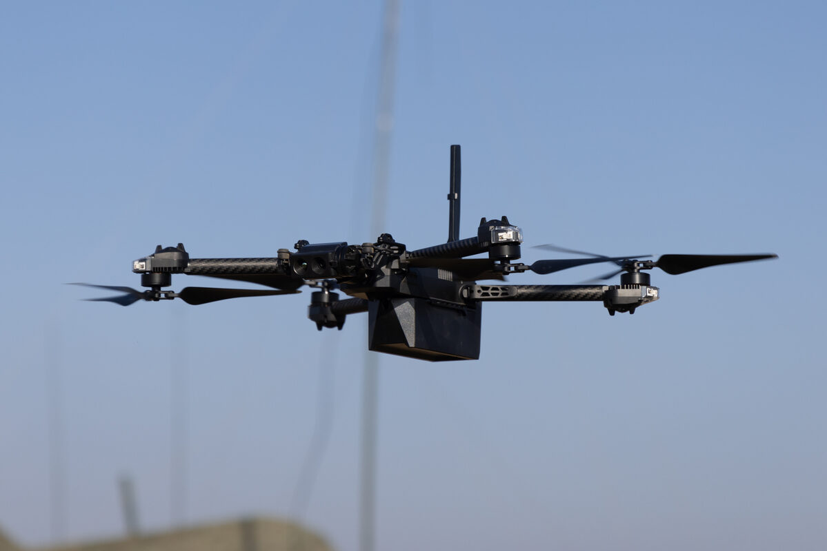
Remote ID was supposed to make every drone in U.S. airspace visible to anyone with a receiver. For a growing share of public-safety flights, it has worked only at short range. The reason is a radio band. Skydio aircraft, widely used in drone-as-first-responder (DFR) programs, broadcast their Remote ID on 5 GHz. According to Dronetag, receivers have so far picked up that band only on omnidirectional antennas. In practice that has limited tracking of a Skydio to about a mile.
Prague-based Dronetag says its new hardware closes that gap. In a release dated Nov. 12, 2026, the company launched Scout Gen 2, a fixed Remote ID receiver that takes both 2.4 GHz and 5 GHz on every antenna, omnidirectional and sector alike. Dronetag says that in its High Performance configuration, Scout Gen 2 can track Skydio aircraft beyond 5 miles (8+ km). The company also states that "no other Remote ID receiver on the market does this." That is a vendor claim, and the trade outlets covering the launch attribute it to Dronetag rather than confirming it themselves.
The Antenna Problem
The technical point is simple. Omnidirectional antennas listen in every direction at once, so their gain, and with it their reach, is limited. Sector antennas focus reception into a narrower arc, which trades coverage angle for distance. Fixed detection sites often pair the two: omnis for nearby awareness, sectors to push range in the directions that matter.
That only helps if the sector antennas can hear the band the aircraft is using. According to Dronetag's announcement and DroneDJ's write-up, existing receivers have generally been limited to omnidirectional antennas for Skydio's 5 GHz Remote ID, which restricted effective detection to roughly one mile. Dronetag's answer is to put 5 GHz on the sectors too. The company says the jump from roughly 1 mile to more than 5 comes from that change.
Skydio's footprint is why this matters. Dronetag's release cites Skydio as reporting more than 1,000 dock deployments with U.S. public-safety agencies. For anyone watching the airspace from the ground, an electronic broadcast is one of the main ways to identify such aircraft.
Matching the DFR Map
Dronetag sets its range numbers against the operating ranges of several established DFR programs. Chula Vista operates at 1 mile, Arlington Police Department at 1.5 miles, and Chattanooga at 3 miles.
The comparison shows what the old limit cost. A receiver that sees a 5 GHz Skydio to about a mile would cover Chula Vista's range and little else. It would fall short of Arlington's and cover only a third of Chattanooga's radius. A receiver good past 5 miles, if field performance matches the claim, would cover the full radius of all three, with margin to spare.
Range figures for radio receivers depend heavily on mounting height, terrain, interference and line of sight. The 5-plus-mile number is Dronetag's own figure for its High Performance configuration and should be read that way. The company is offering agencies a free test unit, and the sUAS News and DroneXL reprints of the release note that reference Scout installations can be viewed in Skyprint, the receiver analytics tool that comes with a Dronetag App account.
What Else Changed
Beyond the 5 GHz headline, Dronetag lists several incremental upgrades:
- 2.4 GHz reception: a 10% Remote ID reception improvement, according to the company.
- Connectivity: LTE now comes standard. The U.S. version is FirstNet-capable, with full support promised in an upcoming firmware update.
- Manned traffic: a new Aviation High Performance configuration adds ADS-B, ADS-L, UAT and FLARM reception, so one installation can show drones and crewed aircraft together.
- Lineup: Scout Gen 2 comes in four configurations (Baseline, Aviation Baseline, High Performance and Aviation High Performance), sold through the Dronetag e-shop. DroneDJ reports all four are available now.
Unmanned Airspace describes the product as aimed at public-safety, critical-infrastructure and security teams. That fits a fixed receiver meant to watch a set perimeter or service area rather than travel with an operator.
The Autonomy Trend Behind It
Dronetag describes itself as operating the world's largest commercial drone detection network, with more than 3,000 receivers. It uses that network's data to make a broader point. Across the Dronetag Detection Network, the company says, autonomous drone operations grew 2.6 times year over year, and 24.9% of recorded U.S. flights were autonomous.
These numbers come from a single vendor's sensor network, and they reflect where its receivers happen to be placed. Even so, they point the same way as the DFR dock deployments: more automated flights. The release also quotes CEO and co-founder Lukas Brchl, who called extending the 5 GHz range "a logical and necessary step."
Why It Matters
Remote ID only works as an airspace awareness tool if receivers can hear the aircraft people actually fly. Skydio broadcasts on 5 GHz, and by Dronetag's account sector antennas could not pick that band up, which held range to about a mile. If Dronetag's range claims hold up in the field, the fix is mostly hardware. Agencies could get detection coverage that matches the operating range of their DFR programs, instead of a ring about a mile wide.
There is a second-order effect worth considering. As autonomous flights grow, by Dronetag's count to roughly a quarter of recorded U.S. flights, telling an agency's own drones apart from other drones and from low-flying crewed aircraft is likely to get harder. A single fixed site that covers 5 GHz Remote ID at range and also picks up ADS-B and similar signals puts both on one picture. The free test units mean agencies can check the numbers themselves rather than relying on the press release.
Sources
- Dronetag Scout Gen 2 Remote ID Receiver Tracks Skydio Out to 5 Miles - DroneXL
- New Dronetag receiver tackles a major Remote ID detection gap for DFR - DroneDJ
- Dronetag's second generation Remote ID receiver extends range - Unmanned Airspace
- Dronetag launches Scout Gen 2, the first Remote ID receiver with 5 GHz on sector antennas - sUAS News