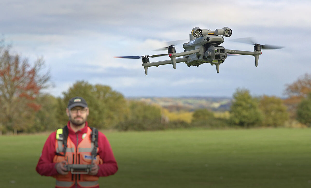
British unmanned traffic management (UTM) company Dronecloud has made the core of its Dronecloud Fly app free. As of Nov. 12, any operator can use it to check airspace restrictions, see other users' active flight plans, file a plan of their own and notify the organizations that own or control the airspace in question. TechTimes reports that this level of coordination was previously available to commercial operators who could afford a paid subscription. Making it free hands the same notification plumbing to hobbyists, solo commercial pilots and small teams.
One part of the launch goes further than notification. According to Dronecloud's announcement, Temporary Danger Areas (TDAs) set up for British Transport Police (BTP) beyond-visual-line-of-sight (BVLOS) operations were previously closed by default. Remote pilots can now ask BTP for approval to fly inside those areas directly through the app. DroneDJ, reporting on the launch, stressed that sending a request "doesn't mean automatic clearance."
Below is what the free tier actually does, what it doesn't do, and where the coverage of the launch disagrees.
What does the free service include?
Dronecloud's release, published via sUAS News, describes four basic functions open to any drone operator through Dronecloud Fly:
- Airspace awareness. Users can see airspace restrictions before they fly. The release and DroneDJ add that operators can review NOTAMs and nearby flight activity.
- Visibility of other flights. Active flight plans filed by other users appear in the app, so a pilot can see who else is planning to operate nearby.
- Flight plan submission. Operators can file their own plans.
- Owner and authority notification. Filed plans can be used to notify airspace owners or authorities. Network Rail and National Highways are the examples given in both the release and DroneDJ's report.
DroneDJ also reports that the free service connects to Dronecloud's existing UTM network. That network matters more than any single feature. Rail Business UK's round-up describes the service as one that notifies rail, road and police airspace owners. A pilot filing a plan near a rail corridor or a trunk road is therefore putting it into a system those owners already use, not sending it into a standalone consumer app.
Chief executive Jan Domaradzki pitched the change at the small end of the market. "Solo operators and small teams can now cover the essential steps before they fly, without a subscription or complex setup," he said in the release.
What changes for British Transport Police danger areas?
This is the most operationally significant part of the announcement, and the part most likely to be misread.
Dronecloud says the TDAs established for BTP's BVLOS drone operations were closed by default. In the release's words, that left legitimate pilots with "no simple way to ask for access." Under the new arrangement, a remote pilot can submit an approval request to British Transport Police through Dronecloud Fly. Rail Business UK reported the same change in its Nov. 12 industry round-up.
DroneDJ's caveat is the one to remember: a request is only a request. Nothing in the announcement suggests the app grants access on its own, and the release says only that operators can request approval from BTP. UASFeed found no statement from British Transport Police itself confirming the process or describing how it will assess requests. Operators should treat the app as a channel for asking, not as permission.
What doesn't the free tier do?
Based on the sources, the free service is a notification and awareness tool. None of the coverage describes it as a substitute for an operator's existing obligations, and none says that filing a plan or notifying an owner amounts to permission to fly. Notifying Network Rail or National Highways tells them a flight is planned. On the information available, it doesn't mean either organization has approved the flight. The release and DroneDJ do not describe what, if anything, the owners do with a notification once they receive it. TechTimes goes further, saying infrastructure owners receive notifications in real time and can respond with updated restrictions, but that is the outlet's description rather than something the release states.
The release also leaves out several details a careful operator would want: what features, if any, stay behind Dronecloud's paid offering, and whether owners can respond through the app. UASFeed found no confirmation from National Highways about how it handles notifications filed through the free tier.
Who is it for? The coverage disagrees
The reports differ on eligibility. Dronecloud's release is headlined as free for "every UK pilot" and says the service is open to any drone operator. DroneDJ says the same, stating explicitly that recreational pilots and small teams are included, and Rail Business UK describes it as available to all drone operators.
TechTimes puts it more narrowly, describing Fly as free for all registered UK drone pilots. That could just be a reporter's assumption about who flies legally in the UK, or it could reflect a sign-up requirement the release doesn't mention. Since the company's own wording is broader, UASFeed treats the TechTimes phrasing as the outlet's framing, not as a confirmed restriction.
TechTimes also places the launch in a context the release doesn't mention. It links the gap Dronecloud is filling to the collapse of Altitude Angel. The outlet reports that Altitude Angel entered administration on Oct. 7, 2025, that Indra acquired its assets in January 2026, and that CHIRP warned pilots about the Drone Assist app in February 2026. That timeline is TechTimes' reporting and interpretation. Dronecloud's release doesn't present the launch as a response to any competitor's failure.
Who is Dronecloud?
Dronecloud was founded in 2018, according to its release. Its named customers are the kind of organizations that own long, linear stretches of British infrastructure and the airspace concerns that come with them: Network Rail, National Highways, Northern Powergrid and Associated British Ports. TechTimes' headline makes the same point, describing the free app as the same system that runs Network Rail operations.
That customer base suggests the business logic. The release says the more pilots are on the platform, the greater the chance of spotting and resolving conflicts, and that owners gain a real-time view of who is flying near their assets. It is reasonable to infer that the free tier also widens the picture available to the infrastructure operators already using Dronecloud, though no source states that as the company's intent.
Why It Matters
Most UK drone pilots, especially recreational flyers and one-person businesses, have had no simple way to tell a rail operator or a highways authority that they plan to fly nearby; the release describes the old process as hunting down the right inbox and hoping an email reached the right person. A free notification path that feeds the systems those owners already use could close part of that gap at the low end of the market.
The BTP danger-area change matters for a different reason. Areas closed by default protect police BVLOS operations, and a formal request route acknowledges that legitimate operators sometimes need access to the same area. Whether that route works in practice depends on how BTP handles the requests, and neither the company nor the coverage has answered that yet. Until the force describes its process, pilots should assume the answer can be no and plan accordingly.
There is also a market-structure angle. If TechTimes' framing is right, UK pilots have lacked a widely used, trusted free tool since Altitude Angel's troubles. A company with established infrastructure customers moving into that space, at no cost to pilots, could set the default for how small operators deal with airspace owners. That is TechTimes' reading, though. Dronecloud's own announcement makes no such claim.
Sources
- Dronecloud makes drone flight notifications free and instant for every UK pilot (Dronecloud press release via sUAS News)
- Dronecloud makes UK drone flight notifications free for every pilot (DroneDJ)
- UK Drone Pilots Get Free Dronecloud Fly; Same System Runs Network Rail Operations (TechTimes)
- UK rail industry news round-up (Rail Business UK)