The low airspace over American suburbs — the couple hundred feet between the rooftops and the bottom of controlled airspace — used to be empty. It is filling up fast. Commercial drone delivery is closing in on one million U.S. deliveries, and public-safety agencies are standing up drone-as-first-responder (DFR) programs at a pace that has caught even the industry off guard. The problem, as the public-safety group DRONERESPONDERS laid out in late June, is that the traffic is arriving years ahead of the automation meant to keep it from colliding.
In a June 29 analysis published by DroneXL, DRONERESPONDERS framed the situation bluntly: delivery fleets and public-safety drones are on a collision course over the same slices of low-altitude airspace, and the unmanned traffic management (UTM) tools that are supposed to deconflict them remain early-stage. The strategic-deconfliction technology exists in pieces, but the governance, the mature technology, and the business model needed to run it at national scale are, in the group's words, still unbuilt.
The Numbers Behind the Warning
Two curves are bending sharply upward at once.
The first is public safety. After the FAA streamlined its Beyond Visual Line of Sight (BVLOS) approval process in May 2025, DFR waivers went from roughly 50 issued over six years to more than 1,000 issued in six months. That works out to about 125 new DFR approvals per month — an enormous acceleration in the rate at which police and fire agencies are cleared to fly drones beyond the pilot's line of sight, straight to emergency calls.
The second curve is commercial delivery, which is approaching one million U.S. deliveries. Each of those flights follows a predictable, repeated route between a fulfillment point and a customer's yard — and increasingly, those routes run through the same neighborhoods where a police drone might launch toward a 911 call at any moment.
The point is not that either use is reckless. It is that both are scaling independently, on separate approvals, without a shared, automated system telling one aircraft where the other is.
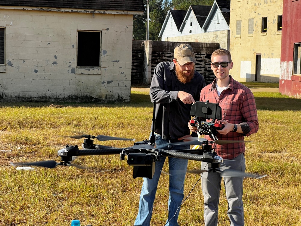
What DFR Actually Looks Like on the Ground
The abstraction becomes concrete when you look at individual deployments, and the examples are piling up week by week.
In Newport News, Virginia, drones are dispatched to 911 calls from four launch sites and can be overhead in under 90 seconds. Orlando has approved a $6.83 million Skydio program. And on June 30, DroneXL reported that Conroe, Texas police were launching their own DFR program with two Skydio X10 drones and two docking stations — funded by asset-forfeiture money that the city council approved back in December 2025.
Conroe is instructive precisely because it is unremarkable. This is not a major metro standing up a flagship air-support division; it is a mid-sized municipal department funding a couple of autonomous drones and docks out of forfeiture proceeds. Multiply that pattern across the hundreds of agencies now clearing BVLOS every few months, and you get a national buildout of low-altitude first-responder traffic assembled one docking station at a time — with no central choreography.
Why UTM Is the Hard Part
Deconfliction sounds like a solved problem: give every drone a way to broadcast where it is and where it is going, and have a system route them around each other. In practice, strategic deconfliction at scale is a governance and business-model problem as much as a technical one.
Who operates the UTM layer? Who is liable when two operators' data disagree? What obligates a delivery company and a police department — entities with completely different missions, vendors, and command structures — to share intent data in real time and honor the same automated instructions? Those questions do not have settled answers, which is why DRONERESPONDERS describes the tooling as early-stage rather than merely immature. The Police1 outlet has framed the same challenge from the public-safety side: agencies increasingly find their DFR operations overlapping with commercial operators, and they need coordination mechanisms that largely do not yet exist.
All of this is unfolding on top of the FAA's advanced-operations and BVLOS framework, including the environmental-review process that governs how expanded drone operations get approved in the first place. That regulatory backbone is what made both the delivery boom and the DFR surge possible — and it is the arena in which the delivery-versus-public-safety airspace conflict will ultimately have to be resolved.
Why It Matters
Low-altitude airspace is becoming shared infrastructure before there is a system to share it. When roughly 125 new DFR programs come online every month and delivery flights climb toward the million mark, the odds of a delivery drone and a public-safety drone wanting the same airspace at the same moment stop being hypothetical. Today, separation leans heavily on manual coordination, geographic luck, and the fact that DFR sorties are still relatively brief and localized — none of which scales.
The stakes are asymmetric, too. A delivery drone that has to reroute or wait costs a company minutes and margin. A public-safety drone delayed or diverted en route to a violent call or a fire can cost far more. If UTM deconfliction is not standardized, governed, and funded before the traffic curves cross, the resolution mechanism defaults to human controllers and after-the-fact incident reports — exactly the reactive posture aviation safety is supposed to avoid. The window to build the automation ahead of the demand is closing, and the June warnings are essentially a countdown notice.
Sources
- DRONERESPONDERS Warns Public Safety Drones and Delivery Fleets Are on a Collision Course Over UTM — DroneXL
- Conroe Police Skydio X10 DFR Funded By Asset Forfeiture — DroneXL
- Preparing public safety for the next era of shared airspace — Police1
- Public Involvement and Environmental Review for Drone Operations — Federal Aviation Administration