South Africa's rhino poaching rate increased 9,000 percent between 2007 and 2022. In 2024 alone, poachers killed 420 rhinos in that country. Black-market horn commands up to $400,000 per kilogram, making it among the most lucrative contraband on earth. Against that backdrop, conservation organizations and research institutions have spent the past decade deploying unmanned aerial systems in protected areas, generating a body of peer-reviewed evidence that is more nuanced — and more promising — than either the program press releases or the skeptics tend to acknowledge.
The Night Shift: Thermal Patrols and the Darkness Advantage
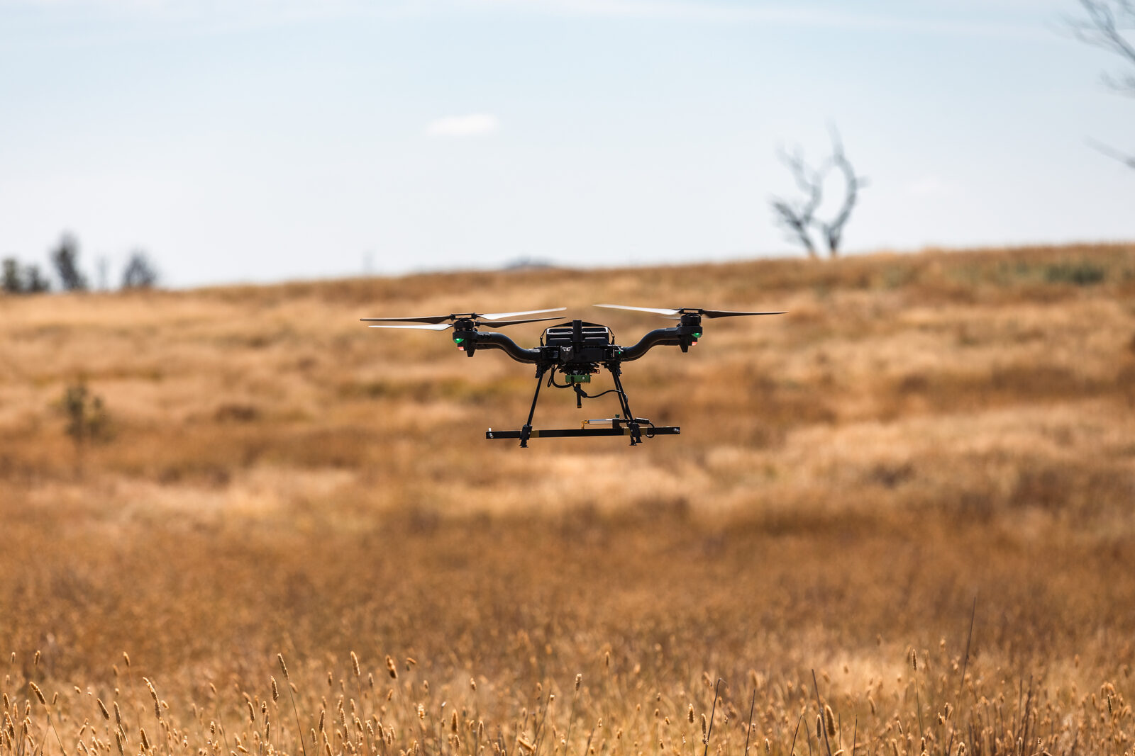
Poachers prefer darkness. Ground patrols, constrained by visibility and personnel ratios that no reserve budget can fully address, have historically ceded night hours to wildlife criminals. "You can't see tracks, it's difficult to see people and it's dangerous," said Otto Werdmuller Von Elgg, Head of Drone Operations at Air Shepherd — a program developed by the Charles A. and Anne Morrow Lindbergh Foundation, a 501(c)(3) non-profit with more than 35 years focused on balancing human development's environmental impact.
Air Shepherd's electric drones fly up to 40 km per sortie with missions lasting up to 3.5 hours. Three-aircraft operating teams coordinate directly with rangers on the ground. The program operates in South Africa, Zimbabwe, and Malawi, with Hwange National Park in Zimbabwe as a primary focus area. Hwange's threat profile is specific: cyanide poisoning of watering holes is the dominant tactic, and the park contains 60–80 active watering holes that require persistent surveillance. Air Shepherd holds a rare regulatory exemption to fly beyond visual line of sight (BVLOS) — an authorization most civil operators never receive — enabling extended-range night operations that human-only patrols cannot replicate. The program collaborates with WWF.
The deterrence effects have been measurable. At Kruger National Park, where 12 poaching gangs were reportedly operating simultaneously, rangers detected 55 intruders in a single month through trail monitoring; following drone deployment, poaching incidents declined, as did attacks on animals and incidents involving park personnel. Craig Sholto-Douglas, Environmental Manager at Kwandwe Game Reserve in South Africa, described the ground-level value: drone coverage "allows us to direct and keep our guys on the ground, safe."
Some practitioners deliberately exploit the fear effect. Field reports from some reserves indicate that drone presence has created a documented fear effect among active poachers. As a deterrence strategy, the logic is straightforward. The ethics of that approach are considerably more complicated, as we will discuss later.
Detection Science: What Thermal and AI Actually See
The intercept model rests on a technical premise: that UAVs can reliably detect humans in darkness and complex terrain. The peer-reviewed record is more candid about limitations than program-level reporting tends to be.
A 2014 PLOS ONE study conducted across 13 farms in KwaZulu-Natal, South Africa — totaling 100,000 hectares with approximately 500 black and white rhinoceroses — ran systematic detection trials with a complete RPAS kit assembled for approximately 13,750 euros. At altitudes of 10–260 meters, still photo cameras confirmed targets in 94 percent of images. Thermal cameras confirmed targets in only 29 percent. Thermal performed best early in the morning and at night, when temperature differential between subjects and environment is highest; at midday heat, thermal cameras become nearly useless. The study recommended an optimal operating altitude of 100–180 meters, balancing image quality with aircraft safety and minimizing detectability by poachers.
A 2021 PLOS ONE field study conducted in Issa Valley, western Tanzania tested automated detection in actual miombo woodland. Twenty flights at 50 meters altitude used five volunteer test subjects per flight as stand-ins for poachers. Thermal infrared (a FLIR Zenmuse XT) achieved a detection probability of 0.69; standard RGB cameras achieved only 0.396 — a difference statistically significant at p ≤ 2×10⁻¹⁶. An automated machine-learning system (Faster-RCNN) pushed thermal detection probability to 0.731 but generated nearly five times more false positives than manual human analysis.
The false-positive problem was terrain-dependent in operationally significant ways. Rock density altered automated error rates dramatically: 11.28 percent at low rock density versus 57.21 percent at high rock density (p = 2.2×10⁻¹⁶). Operators who dispatch rangers to investigate every automated alert in rocky terrain will exhaust their ground forces on phantom contacts. The Tanzania researchers named the core urgency: "a delay of just 5 min is long enough for a rhino to be killed and de-horned." Detection latency is not an abstract metric.
Coverage constraints compound the problem. Flying at 150 meters and 30 km/h, one RPAS covers approximately 711 hectares per flight hour. A 100,000-hectare reserve would require roughly 140 flight hours — nearly six days of continuous airtime — for full coverage. Close-range systems typically deliver 30–45 minutes of endurance per battery set. In practice, drone coverage is prioritized around high-threat zones rather than achieving blanket surveillance.
The WildTrack organization — a global network of biologists and conservationists — partnered with UC Berkeley, the University of Göttingen, Duke University, and the Kuzikus Wildlife Reserve in Namibia to push identification accuracy with onboard AI. Their platform, developed with NVIDIA and published in PeerJ in 2022, equipped a Parrot Anafi drone with an NVIDIA Jetson Xavier NX edge-compute module running YOLOv5l6 object detection. The system correctly identified black rhinos 81 percent of the time and giraffes 83 percent of the time. Training incorporated generative adversarial networks and synthetic data generation to compensate for the limited real-world training images available for endangered species. Onboard inference delivers alerts to rangers in near-real time rather than requiring post-mission footage review. With approximately 5,500 black rhinos remaining globally, that margin is narrow.
Beyond Land: Marine Surveys and Non-Invasive Biology
Ocean Alliance — founded in 1971, based in Gloucester, Massachusetts — developed the SnotBot: a modified consumer drone that intercepts a whale's exhaled blow to collect breath condensate. The whale remains unaware of the sampling. The collected material yields DNA, stress hormones, reproductive hormones, and microbiome data — biological information that previously required biopsy darts or tissue collection from stranded animals. Ocean Alliance has collected over 355 blow samples from six whale species across five countries: Gabon, the Dominican Republic, Mexico, Argentina, and the United States, with the program registered in the UN SDG Partnership Database and a partner network that includes NOAA, FLIR Systems, and Oregon State University.
In 2022, Ocean Alliance became the first organization in the world to successfully deploy suction-cup data tags on whales using drones, described as "one of Ocean Alliance's most significant contributions to whale science in our 50+ year history." SnotBot also supports disentanglement operations — identifying whales entangled in fishing gear — and body-condition monitoring via photogrammetry.
In the Arctic, WWF has used drones in Eclipse Sound off Baffin Island to observe narwhal behavior and in Cumberland Sound, Nunavut, for bowhead whale research and in Tremblay Sound for narwhal footage. A 2017 WWF drone video captured narwhals using their tusks to stun prey before eating — the first documented observation of this behavior — and generated over six million views. Bowhead whale research now enables individual size measurements, distinguishing-mark cataloging, and detection of population shifts correlated with climate change. Non-invasive monitoring tools that yield publishable biological data without stressing the subjects represent a qualitative shift in what marine conservation science can accomplish.
Ethics, Communities, and the Limits of Aerial Surveillance
Drones carry social costs that the technology's advocates have been slow to reckon with. A 2015 peer-reviewed analysis by Chris Sandbrook of the UN Environment Programme World Conservation Monitoring Centre, published in Ambio, identified the primary risks: community privacy violations, fear responses driven by rotary-wing drone noise, data security vulnerabilities, and the potential to undermine decades of progress toward inclusive, community-based conservation approaches.
The fear-as-deterrent model sharpens the tension. The fear-as-deterrent approach reflects a deliberate strategy with measurable deterrence value. But Sandbrook's analysis documented that the same fear response affects local communities, not just poachers, and that widespread drone surveillance risks reversing more than 20 years of movement away from "fortress conservation" that excluded and alienated the communities who live closest to wildlife. Physical hostility has followed: drones have been shot down in the United States and Malta.
The regulatory landscape remains fragmented. Kenya had banned drones entirely at the time of Sandbrook's study; South Africa had only draft regulations; India's deployment plans had been halted by the Ministry of Defence. UK rules required drones to weigh under 7 kilograms, stay below 122 meters, remain within visual line of sight, and avoid populated areas. Air Shepherd's BVLOS exemption is the exception, not the model. The 2014 KwaZulu-Natal study found no regulatory framework existed in South Africa at that time for RPAS operations beyond visual line of sight.
Sandbrook found an almost complete absence of field data on the actual social impacts of conservation drone programs — not program-level metrics like intruder counts, but data on how affected communities experience aerial surveillance. He called for Free Prior and Informed Consent protocols before deploying UAVs in areas involving local communities, for privacy impact assessments, for blurring incidental imagery, and for restricting law-enforcement drone use to state agencies rather than private conservation operators. Most of these recommendations have not been widely adopted.
The question for conservation planners is not simply whether drones work — the evidence establishes that they do, within defined conditions and significant caveats. It is whether the operational model, the ethical framework, and the regulatory structure can mature fast enough to match the rate at which the underlying crisis is advancing. Drones extend ranger reach into terrain and darkness that ground patrols cannot cover; they generate biological data that was previously impossible to gather non-invasively; and they produce deterrence effects that some parks have measured in reduced incidents. They are a genuine force multiplier. They are not a solution.
Sources
- EarthTalk — Air Shepherd Drones Battle Poachers
- Ocean Alliance — SnotBot Program
- WWF Living Planet Technology Hub — Drones/UAV Monitoring and Surveying
- Africa Defense Forum Magazine — AI-Powered Drones Lift Anti-Poaching Efforts to New Heights
- PLOS ONE / PubMed Central — RPAS Anti-Poaching Field Study, KwaZulu-Natal 2014
- NVIDIA Blog — AI Drone and Rhino Poacher Detection
- PLOS ONE / PubMed Central — Thermal UAV Detection Field Study, Tanzania 2021
- UN SDG Partnership Database — Drones for Whale Research: SnotBot
- Ambio / PubMed Central — Social Risks of Conservation Drones, Sandbrook 2015